Features
Everything on the way, kept
One app for the whole walk: recording it, seeing it on the map, keeping its photos in place, and coming back to it as a report, a replay, a video or a guide.


forWalking: Tours Map Photos iPhone and Android
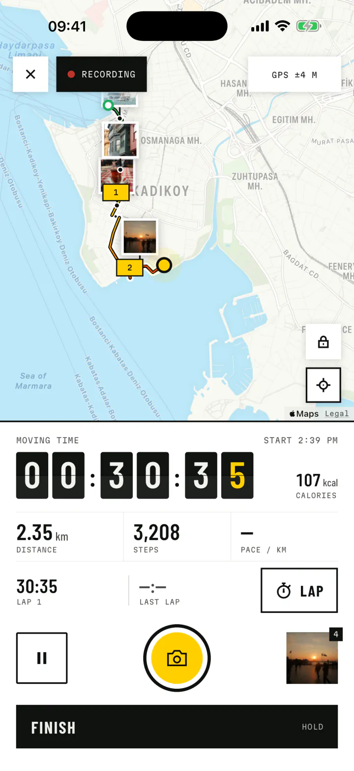
Recording
Starts with one sign. Keeps going in your pocket.
The recorder lives in the phone itself, not only in the app on screen. Lock the screen, switch apps, play music, take a call: the walk goes on. If the app is closed while you walk, it picks the walk up again with everything that was saved.
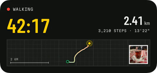
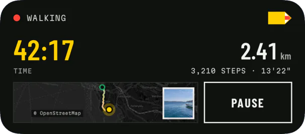
- A live walk screen with a split-flap timer, distance, steps, pace and calories.
- Pause and finish from the app, the notification or, on iPhone, the Live Activity.
- Laps, like a stopwatch, and distance alerts with a chime that only lowers your music.
- A touch lock that protects pause and finish while the map and camera stay free.
- A readiness check before you set off: location, precise location, notifications, step counting and, on Android, battery optimisation.
4,166 Steps on this walk
Steps on this walk
The map
A real map, and a wire that shows the way
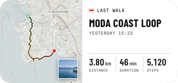
Every route is drawn on a real map, never as a squiggle on a blank page: Apple Maps on iPhone, a clean street map on Android. Inside the route line runs a thin wire that starts green, turns yellow and ends red, so an out-and-back walk or a loop still tells you where it began and which way it went.
- Kilometre plates along the route, like posts on a trail.
- Start ring and finish flag in the wire's own colours.
- Kilometres or miles, a 12 or 24 hour clock.
Photos
Pinned where you took them
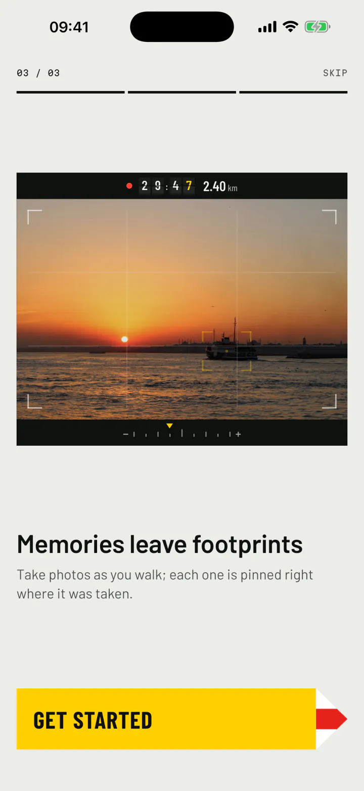
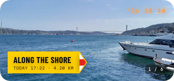
Tap the yellow camera on the live walk and the quick camera opens right there, without leaving your walk. Each photo becomes a print on the map at the exact spot it was taken, with the time stamped in its corner. Prefer the phone's own camera? You can choose it in Settings.
- Photos from your gallery can join a walk too, placed on the route by the time they were taken. You can move any of them by hand.
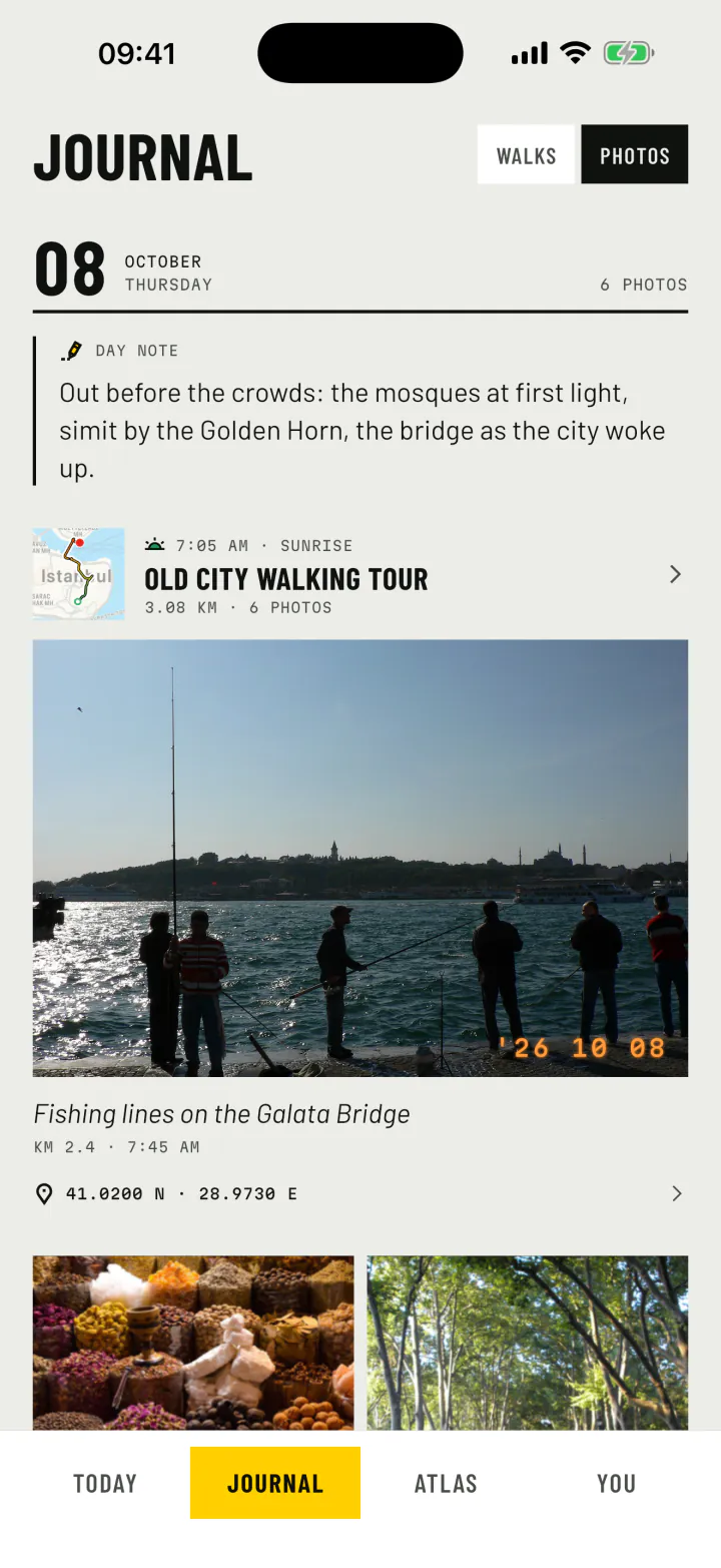
- Captions for every photo, and a note for every day.
- A memory viewer that shows when and where each photo was taken, and which walk it belongs to.
Trail report
The walk, told back to you
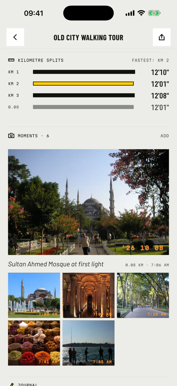
Finish a walk and it opens as a report under its own title plate. Rename it, add a note, change the travel mode of a stretch. All the numbers are there, and so is the shape of the walk in time.
- Distance
- 3.08km
- Moving time
- 37:19
- Steps
- 4,166
- Calories
- 160kcal
The timeline shows when you moved, when you paused and when each photo was taken. Kilometre splits show your pace, kilometre by kilometre.
- Km 112'10"
- Km 212'01"
- Km 312'08"
- 0.0812'01"
Replay and video
Play it back. Make it a film.
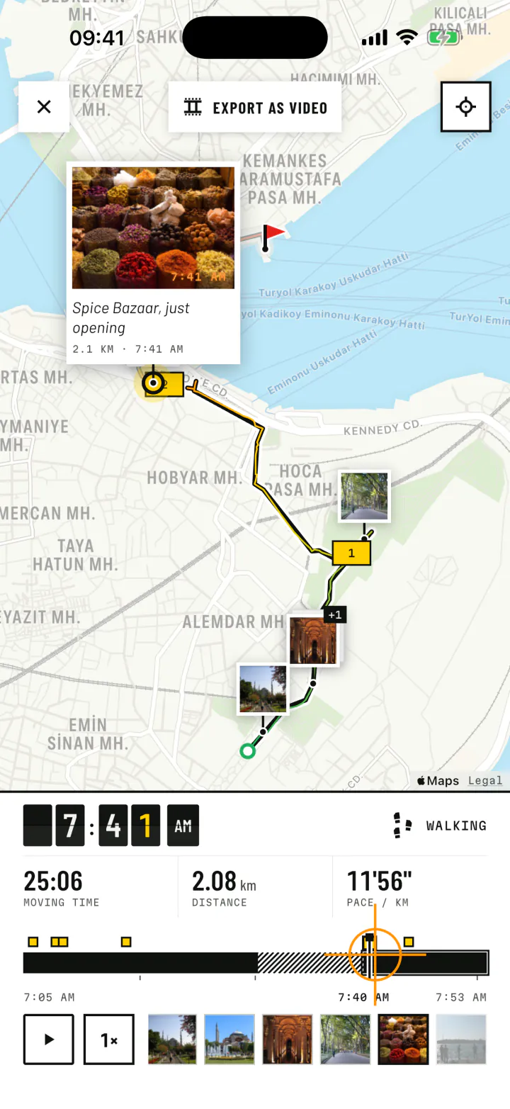
The replay draws the walk again on its map while the clock flips and the photos rise where they were taken. Drag the timeline to any moment, or let it play.
Export the replay as a video, in a cinematic look with a map that follows you, or a plain one that draws the route on stone. Pick what shows on screen, add a start card and an end card, and lay music underneath: one of the bundled tracks or your own file.
- 9:16Story
- 3:4Post
- 1:1Square
- 16:9Landscape
Sharing
Share a card, a video or the way itself
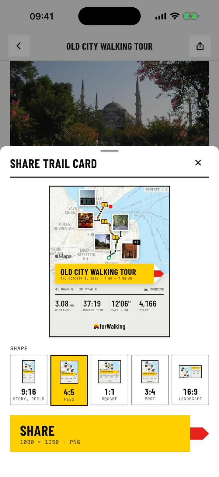
A share card puts the route, the title, the numbers and your photos in one picture, in the frame your app of choice likes best. And because every photo knows its place, a walk can be shared as directions that others can follow.
- 9:16Story
- 4:5Feed
- 1:1Square
- 3:4Post
- 16:9Landscape
- Each photo point as a map link, in Google Maps or Apple Maps.
- Directions on foot through all the photo points, in order.
- GPX for Komoot, Strava, Google My Maps and watches, and KML for Google Earth.
Journal and Atlas
Day by day, and all at once
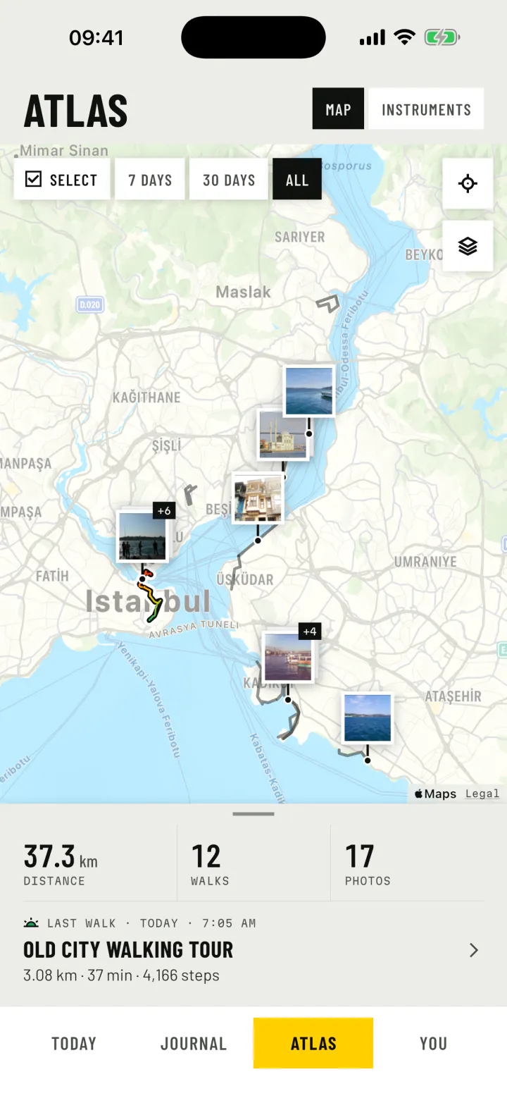
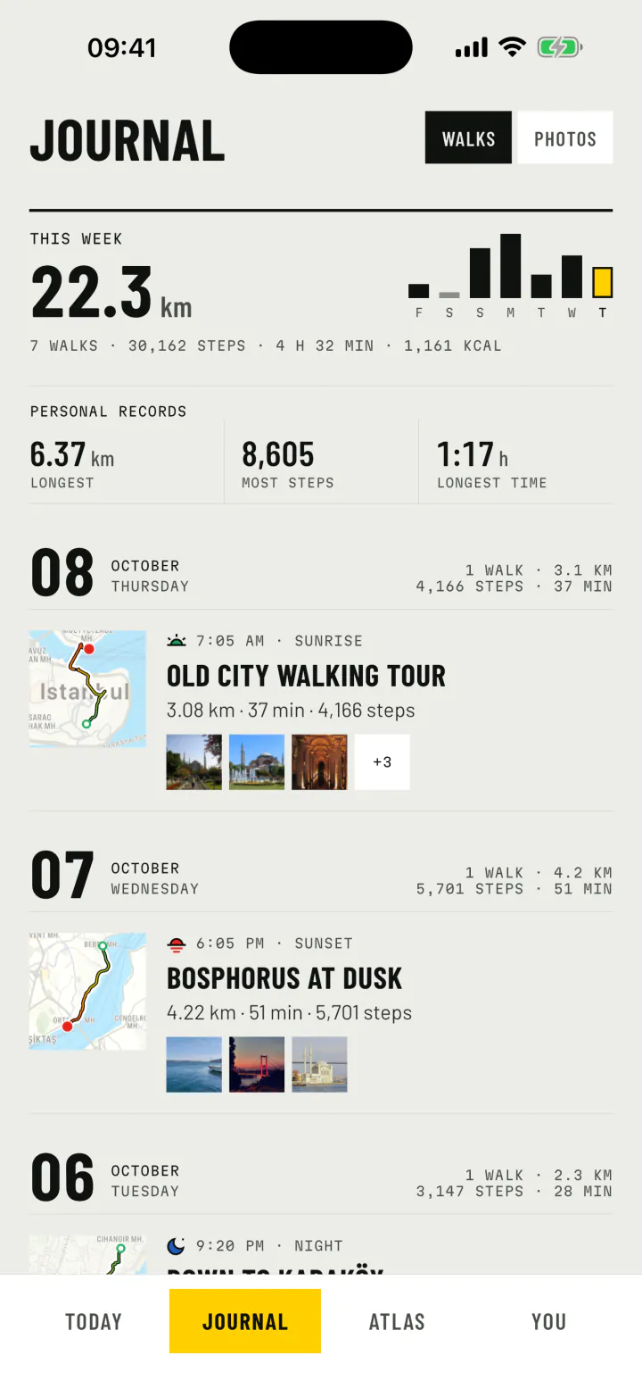
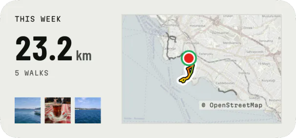
The Journal is your walking diary: each day with its steps and walking time, each walk with its route and a strip of its photos, the week's totals at the top and your personal records below them. Switch it to photos and your days become a photo diary.
The Atlas draws every walk on one map. Filter by the last 7 or 30 days, or select the walks you want to see together.
Today and widgets
The day at a glance
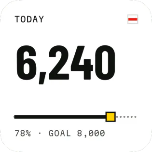
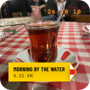
Today is a pedometer for the whole day: steps against your goal, distance, energy and walking time, with your last walk and its photos. Widgets bring it to the home screen, along with a slideshow of your walk photos and the walk in progress.
Photos from Wikimedia Commons (CC0): August Dominus, Hamdigumus, Arefin Shamsul, eXploration Etoile. Map data © OpenStreetMap contributors. Credits
Travel modes
A ride is never a walk
forWalking recognises stretches by car, ferry and plane, and tells cycling and running apart from walking. You can set a stretch yourself on the live walk or in the report: bus, train, motorcycle, e-scooter or horse. Rides stay on the map and the timeline, and stay out of your walking numbers.
- WalkingDetected
- RunningDetected
- CyclingDetected
- CarDetected
- FerryDetected
- FlightDetected
- Horse ridingYou choose
Time of day
Dawn, day, dusk, night
Each walk and photo carries the sky it happened under, from the real sunrise and sunset where you were.
- DawnOut with the sunrise
- DayIn full daylight
- DuskInto the sunset
- NightAfter dark
Privacy, languages, looks
Yours, in your language
No account
Walks, routes, photos and notes stay on your phone. Nothing to sign up for.
You choose what leaves
A walk or photo leaves the app only when you share it, and goes where you send it.
Anonymous usage data, optional
Counts and crash reports help us improve the app. Switch them off in Settings at any time.
20 languages
English, Turkish, Spanish, French, German, Japanese, Arabic and more, right to left included.
Light and dark
A bright daylight look by default, and a night look designed on its own.
iPhone and Android
Home screen widgets on both, and the lock screen and Live Activity on iPhone.